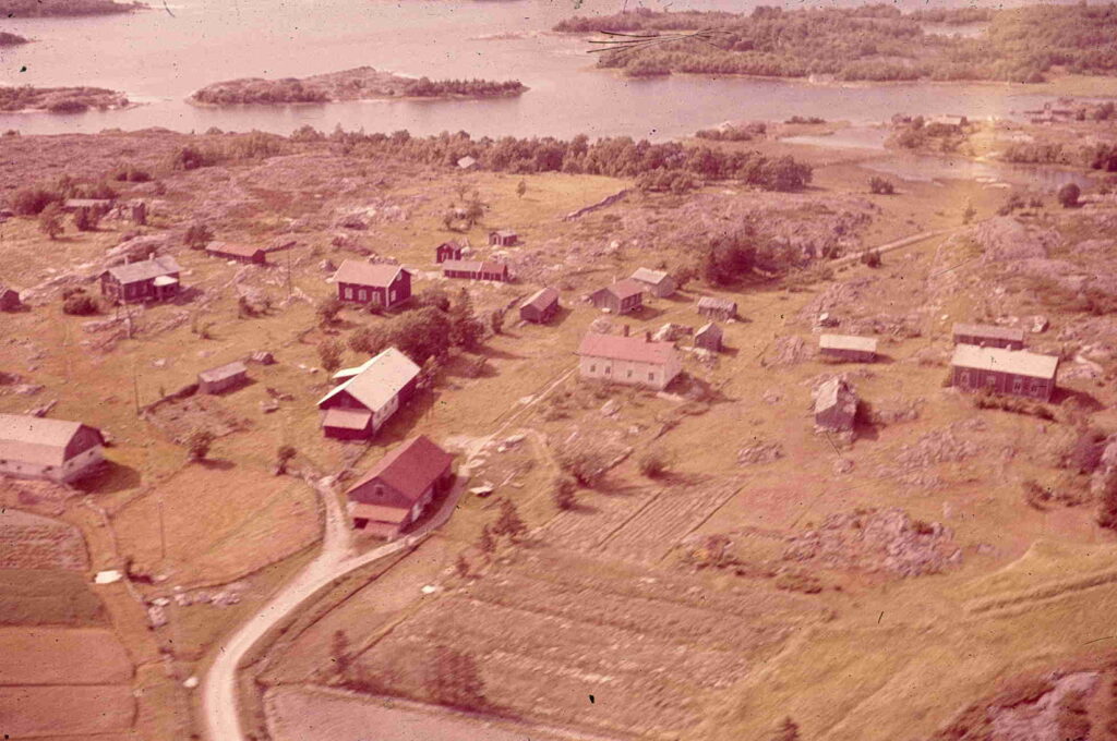
Aerial view of Baggholma, my home island, as it looked in 1960. The yellow house with a red roof in the middle is Norrgårds, my childhood home. The smaller buildings above and slightly to the left are different farm buildings, the narrow one has one storage room for the meat supply, another for the granary and a third for seasonal household items. The other buildings are a wood shed, a smoke sauna, a workshop, and a hen house. The island was accessible only by boat in the summer time and over ice in the winter. It was home to about 20 people, and had no store, and no school. To go to school or the store or to church we went by boat in the summer and on ice in the winter. In the fall when the temperature went negative and the water started to freeze there was a period when the sea was partway ice covered and partway open water when special methods were required.
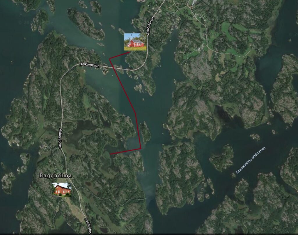
The picture below, of Baggholma and the neighboring island Brändö from Google Earth, shows the locations of the school in relation to our house, with a red line indicating the route we used to get to school during this period when the water was transitioning from liquid to solid ice. Click on the map picture to see how we proceeded.